- Details
- Written by Luca Pantano
- Category: Smart Government
- Hits: 1567
These terms for some years recur in sector publications, even if the meaning is not always clear. Below I try to define them.
Viral sensing: acquisition of new data and information through existing digital networks, collecting the traces left by people in their daily activities (money transactions, displacements, fruitions of services ...), aggregating them in order to reconstruct the information landscapes which host social phenomena.
Sensor Network: networks of sensors to detect data related the town activities. A large mass of data, enriched with spatial and temporal reference, allows not only a description of the phenomena but also to create a virtual model of the environment for the domain of interest.
Crowd sensing: also known as the Internet of people, is based on the potentialities of social media tools typical of the web 2.0; individuals collect their experiences and share them in real time, influencing others in their choices; information that is collected is subjective, but the strong interaction between users reveals a precise description of the phenomena considered.For this reason it is an excellent way to obtain information about the social dynamics, acquiring contributions from any person without particular limitations. Instead, it is less suitable to collect scientific data, as in this case it is necessary to form a closed group of volunteers with appropriate training and equipment, defining the timing and method of data collection.
In urban areas, the data collected can be presented to the citizens through information devices installed at key locations in the city, also allowing the collection of user opinions.
- Details
- Written by Luca Pantano
- Category: Smart Government
- Hits: 1540

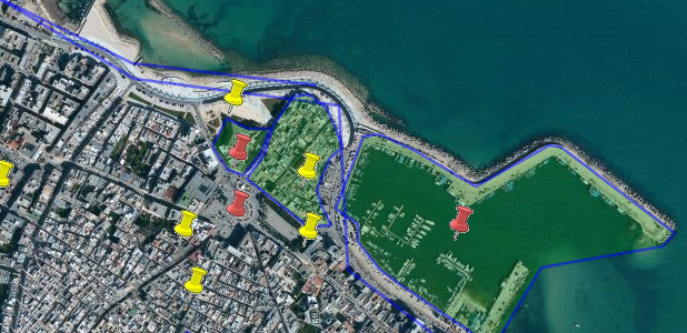
Mola di Bari - map of geotagging collected during the public consultation
Prototype of the system of public consultation carried out in 2007 to manage the participatory process in the municipality of Mola di Bari.
The design and the realization of this prototype falls within the activities envisaged from the agreement stipulated between the City of Mola di Bari, the IUAV University of Venice - Department of Spatial Planning - and the Polytechnic of Bari - Department of Architecture and Urban Planning - for the realization of the municipal Geographic Information System.
Refer also to the final report of the activity (in italian language), in the section on public consultations.
(www.ricercasit.it/public/documenti/MolaDiBari/RapportoConclusivo/RapportoSITMolaDiBari.pdf)
The design of the public consultation system has been treated in my dissertation for the Bachelor degree in Geographic Information Systems, at IUAV University of Venice, in the academic year 2005-06, entitled:
"Public consultations and partecipation processes at the municipal level: design of a system for dissemination and public participation, addressed to the citizens and integrated into the municipal geographic information system, applied to the case study of the town of Mola di Bari (Italy)."
Here you will find the pdf document and the presentation slides (in italian language).
(http://win.analisiterritorio.org/IUAV/Tesi_Pantano_Sistema_di_ascolto.pdf)
http://win.analisiterritorio.org/IUAV/Slides_Pantano_Sistema_di_ascolto.pdf
- Details
- Written by Luca Pantano
- Category: Smart Government
- Hits: 1491

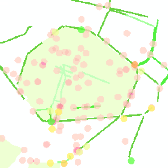
Alessandria, city center - map of issues related to the urban cycling mobility
The urban mobility issue is topical mainly due to the worrying level of pollution in our cities, but it is also an opportunity to reflect on urban paths and to rethink the functions of public spaces, creating meeting places to promote the relationships between citizens. Regarding the urban land, in addition to offering an efficient public transport system, it is necessary to implement actions aimed at fostering pedestrians and encourage the use of bicycles as everyday transport mode.
The action of the government operated with decisions "from above" does not allow the involvement of citizens in identifying the objectives to pursue and often leads to contradictory results. In addition, every new initiative requires an experimentation, which must be accompanied by a process of monitoring the effects.
The proposal is to involve the social networks of citizens in verifying the effectiveness of the actions taken, asking them to take an active role. It must be created a public space for social sharing, in which citizens can discuss the different ways of getting around the city, integrating volunteer activity of collaborative data collection aimed at verifying the results of government choices. The desired outcome is the creation of a knowledge framework on urban mobility, which is supplementary to the official ones, built by the users of the urban system.
This work aims to arrange the data collected in public databases (road cadastre, road accidents, pedestrian and cycling paths) and integrate them with data describing urban phenomena collected involving citizens, both as volunteer data collectors, and also as participants in public debates on the topic of urban road safety. The perception of danger perceived by vulnerable users, which is the main factor in choosing to avoid the bicycle as a mode of transport, is then compared with the actual accident rate data, using analysis that fit to the specificities of the situations and places.
The proposed system, consisting of the functions of gathering reports and data representation on the map, serves primarily pedestrians and cyclists, but it can be useful to all citizens, as a info channel on the ongoing dynamics, and as a feedback channel for collect reports on critical situations of actual or even perceived insecurity.
The proposed monitoring methodology and the functionalities described herein have to become tools used by the citizens’ associations that deal with encouraging cycle-pedestrian urban mobility.
By analyzing collected data, you get a overall picture of the critical issues related to the mobility of the vulnerable users, that will surely be of interest to the local administration that has to make government choices, in order to guide the actions to the attainment of a high public benefit.
Try the map visualization features: www.analisiterritorio.org/mobility/mappaAL.html
" Monitoring and sharing of issues related to the urban cycling mobility"
Supervisor: prof. Luigi Di Prinzio
Laureando: Luca Pantano
See the full publication of the dissertation, in Italian (pdf - about 10Mb)
See the presentation of the dissertation, in Italian (pdf - about 4Mb)


